Narrowboat News - Edition 10
We’ve made it across the River Ribble, up to Preston and onto the Lancaster canal. It was a very interesting day!

We moored up the day before departure at midday, there were several other boats moored in the departure area, and had to wait for a space to open up. It was hard to know which of the boats were simply moored and which were taking the link the following day. In the end there were three boats in our group.

None of the three had taken this route before. One boat had hired a local boatman to assist with their passage.
I couldn’t scope out the sealock that we were to use as it was apparently controlled and operated by the local boatyard and there was no pedestrian access beyond where we were moored.
Instead I walked the other way to take a look at the River Douglas onto which the lock would release us.
It was near low water, and all that could be seen was winding a muddy banked stream, not dissimilar to the Shebenacadie river at low water.
We hadn’t seen any sign of who would be organizing our departure, but early evening brought a knock on the cabin roof and a chap from the boatyard told us to turn up at the lock at 0840 (about 1.25 hours before high time and 50 later that the time specified by CRT).
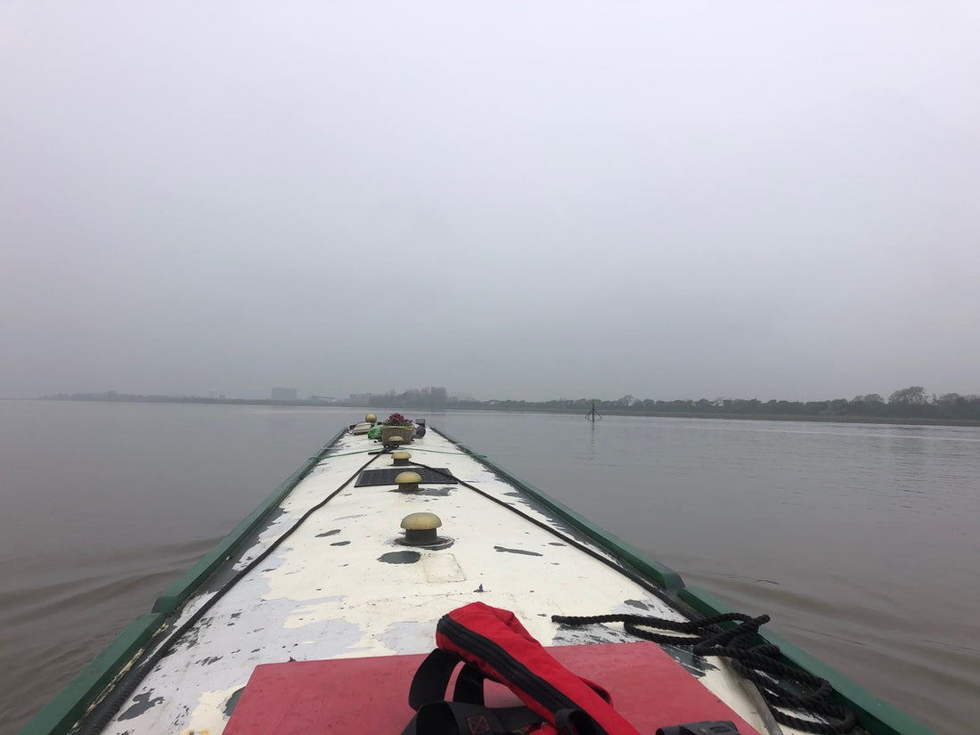
We rose and shone, bright and early and prepped the boat for sea, moving all the bottles and loose items from worktops (narrowboats rarely rock and roll, there are no fiddles or gimbals), brought all the flower boxes down below (centre of gravity). There was happily, little or no wind but the visibility was slightly reduced. Misty and overcast. I wasn’t sure what the visibility restrictions would be. We did need to be able to see the marks in the channel.
We flaked out the anchor cable (and attached the bitter end to the boat for good measure). 
We donned our borrowed lifejackets and entered the lock along with another boat, and the dock team operated the lock dropping us to the level of the river. The sea lock has two sets of gates to allow for the water outside to be either higher or lower than the canal.
The river was running to the right of the lock and we had to exit from stationary at full power and stay left to avoid the bow being grabbed by the current and swung around. We exited first, shortly followed by the second boat. We were chugging along at much higher revs than usual to make any headway against the banks, probably loosing 2 - 3 knots against the current. The aim of the game is to get to the confluence of the Douglas and Ribble at about high tide. As the river widened out we gained speed over the ground.

It was misty and very atmospheric with lots of wonderful wading birds, sheep and cattle grazing on the salt marshes on either side. It took about 1.25 hours to get to the Astland Lamp. The third boat that locked through after us with the local aboard, really put the hammer down and overtook both of us before we reached the Ribble.
The weather continue calm but the mist turned to drizzle but we could see far enough to make out the channel markers. We kept an eye on the boat in front, and a count of the markers, it took about an hour more once we had turned around the Astland (it might tempting to cut inside but you would run aground), it was hard to determine how strong the tide flow against us was. We could make out a green traffic light that indicates that the link is open from quite a distance, the overcast conditions helped with this. If you don’t arrive in time to turn you have to continue onwards for another hour to Preston Marina. 
The black and white CRT markers on either side of the channel don’t come into view until the last minute, the right and green channel posts were most helpful in determining where the actual channel opened between the mud banks.
Having made the turn and found the gap, there was another 10 mins of fast steaming in another twisty-turny river, Savick Brook, with the tide distinctly going down. Here we reached the “rotating sea lock” manned by a CRT chap, nothing actually happened over that he told us to keep going and moor up for a few minutes until we told we could go on. The sea lock was kept open until the third boat came through. I imagine there must be another double gate arrangement there but it wasn’t clear how or what it did. 
Once the sealock was closed we were back into fairly controlled water and no longer at the mercy of the tides. We tied up along side the first boat briefly awaiting the word to proceed. We had been told that the brook was very restricted and that you feel as you were in the jungle. It was very narrow and winding but could be done at a gentle pace - like being aboard the African Queen. Apparently you can get a 62’ x 10’ 6’ x 2’ boat up there - 57’ x 6’10’ was plenty thank you.
There are then a series of 5 ascending locks, the first is operated by CRT, the remainder you do yourself, all connected by wiggly-windy bits populate with several Danger signs announcing spillways and storm drains that might let loose at any time… also a caution about ‘a golf area’ does that equal “Wear a hard hat?”
The final flourish is the last set on connected locks (known as a staircase) which after going under a railway and road bridge there is just enough room to hang a right hand turn into a dead end and then back up into the lock chamber. I’ve never done a lock backwards before. Once both boats were slotted in, the lock is operated by CRT from what feels like a great distance above you. There are three chambers and then magically you have arrived! Backing out of the lock and making another right angle turn you are headed to the mainline. Right to the short route to Preston or left for the remainder of the canal, which is navigable for about 40 miles until the M6 rudely interrupts it’s progress to Kendal.
Lucy